
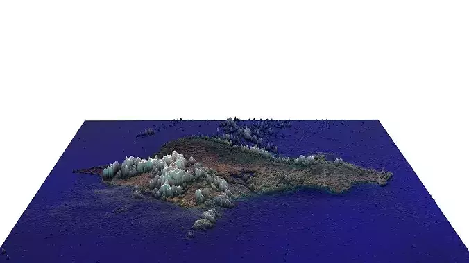
Oahu Island 3D model
TRY BEFORE YOU BUYSend us a message to get a test scene of this productDownload a generic sample - www.each.city/sampleWHAT IS INCLUDEDDETAILSCoordinate reference system -Scene size - Entire area (refer to promo images for the exact scene size)Units - GenericScale - 1 : 1Updated - July 2026KEY BENEFITS24/7 customer supportFile Format (max)Any scene size or crop to an area-of-interest — for best performance and format compatibility (request before paying)Buildings, land-use areas, roads and railways split by type (layers / named objects)Detailed landmarks with regular updates and improvementsHigh-resolution surface texture (1-meter resolution satellite image)The surface is flat, easy to add details, and edit geometryProduct is ready to render out-of-the-box (3ds Max + V-Ray Render)PRESENTATION IMAGES4K high-resolution renders (refer to images for level of detail and scene size)Produced in 3ds Max (other software requires its rendering settings)MATERIALSTrees, vegetation, land-use and airport surface with the textures assignedTextures are included2026 UPDATETERMS & CONDITIONSOnly applies to new customers who placed an order through the HIRE ME optionFully customizable model based on the options listed belowFast turnaround, flexible pricing and discountsSCENE SIZEExtended area up to 71 x 48 km — or any size options or slice to tilesMOST ACTUAL DATA100% real buildings coverage — unlike other sellers, we don’t use AI generated building footprintsCombining multiple sources — you may povide us with any dataset to include in the modelGEOREFERENCINGCorrect coordinate reference system — unlike other sellers, we use only original reference system for each cityGeospatial anchors — allows you to place 3D content at any given latitude and longitudeTOPOGRAPHY TERRAINUp to 1-meter accuracy digital terrain model (DTM) — quad meshMultiple terrain LODs — triangle mesh optimized for the best polycount / details balanceBuildings and roads placed on the optimized terrainSeparate land surface and water bodiesHigh-resolution satellite or surface texture — up to 0.2 meter accuracyTEXTURINGHigh-resolution surface texture — satellite image up to 0.5 meter accuracyStreets and roads with markings texture — UV mapped along the center lineFILE FORMATSmax — Autodesk 3ds MaxIMPORTANT NOTEAny options under 2026 UPDATE section can only be ordered using the HIRE ME — flexible pricing applies
Digital Delivery
This is a digital product. No physical item will be manufactured, packaged, or shipped. Once your payment is confirmed, your files will be available to download.
A download link is emailed to you right after checkout, and the same files stay available from your order confirmation page — no waiting on the mail.
Before You Buy
- Exact file formats and what's included are listed in the product description above — check it matches the software or hardware you plan to use.
- Preview images illustrate the design; on-screen colors and final output can vary slightly depending on your device and software settings.
- Digital files are non-refundable once downloaded, since a download can't be "returned" the way a physical item can — see our Return Policy for details.
Usage Rights
Purchased files are for your own use under the license tier selected at checkout — they may not be resold, redistributed, or re-uploaded as a standalone digital product. Full terms are in our Terms of Service.
Customer Reviews
No reviews yet. Be the first to share your experience!