
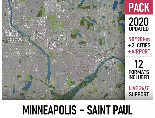
Minneapolis - Saint Paul 3D Model Pack
This is exact and accurate to scale 3D city model of Minneapolis - Saint Paul and its surrounding area based on GIS data (September 2020) File units: Meters Scale: 1:1 NO MISSING BUILDINGS!This is the only product on the market with 100% buildings coverage from 125,192,184 buildings footprint polygon geometries in all 50 U.S. StatesPACKAGE CONTENTS This collection includes 3 scenes of different size 90 x 90 km - Complete scene (Twin Cities and surrounding area)) 30 x 20 km - Minneapolis 30 x 30 km - St. Paul 15 x 15 km - Minneapolis-Saint Paul International Airport (MSP) You may request any specific area crop FORMATS INCLUDED MAX - Autodesk 3dsMax FBX, OBJ, DAE - Exchange Format UNITYPACKAGE - Unity 3D 3DM - Rhino 3D SKP - SketchUp BLEND - Blender C4D - Cinema4D MA, MB - Autodesk Maya DWG, DXF - Autodesk AutoCAD RVT - Autodesk Revit / request PLA, PLN - ArchiCAD / request LS - Lumion / request PRODUCT INFO KEY BENEFITS FREE - Live 24/7 support FREE - Update to the latest data FREE - Crop to any area, or slice to tiles FREE - Format conversion to ANY software 100% buildings coverage (from 125,192,184 buildings footprint polygon geometries in all 50 U.S. States) Realistic low-poly trees and forests (max, fbx included, other formats by request) Buildings, landuse areas, roads and railways split by type (see scene structure) The surface is flat, easy to add details and edit geometry (terrain on request) EXTRAS (on request) Administrative boundaries of all levels (named polygons or outlines) Road and railway splines for traffic animation Public transport stops with names PRESENTATION IMAGES Product is ready to render out-of-the-box (3dsmax + corona renderer) 4K high-resolution realistic renderings (refer to images for level of detail) MATERIALS Buildings are UVW mapped, split by material IDs, no textures assigned Trees, vegetation, landuse and airport surface with the textures assigned SCENE STRUCTURE - model is organized by layers, all objects split by type and named properly BUILDINGS residential commercial industrial public sports parkings transport ROADS highways primary secondary tertiary residential service RAILWAYS train city tram subway monorail PAVEMENT sidewalk footway cycleway LANDUSE residential public industrial construction agriculture VEGETATION forest grass scrub park garden cemetery recreation NATURAL land sea lake river AIRPORT building (terminal, gates) apron taxiway runway SUPPORT - please send us a message 24/7 FREE - Product update with the latest GIS data $299+ - Request any other city or area (same day delivery) $199+ - Add terrain based on SRTM or LIDAR elevation data (3-5 LODs optimized)
Digital Delivery
This is a digital product. No physical item will be manufactured, packaged, or shipped. Once your payment is confirmed, your files will be available to download.
A download link is emailed to you right after checkout, and the same files stay available from your order confirmation page — no waiting on the mail.
Before You Buy
- Exact file formats and what's included are listed in the product description above — check it matches the software or hardware you plan to use.
- Preview images illustrate the design; on-screen colors and final output can vary slightly depending on your device and software settings.
- Digital files are non-refundable once downloaded, since a download can't be "returned" the way a physical item can — see our Return Policy for details.
Usage Rights
Purchased files are for your own use under the license tier selected at checkout — they may not be resold, redistributed, or re-uploaded as a standalone digital product. Full terms are in our Terms of Service.
Customer Reviews
No reviews yet. Be the first to share your experience!